Mar 25, 2025
Southwest Madeira: Cliffs, Coastline, and Hidden Pull-Offs
The southwest corner of Madeira is where the island's cliff roads get serious, and where most tour routes run out before they reach the best part.
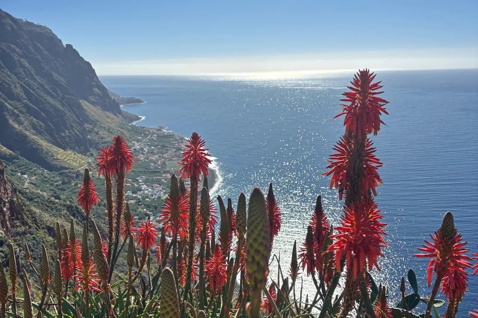
The southwest of Madeira doesn't get the attention of the west or the east. There's no single landmark as famous as Porto Moniz's lava pools or the Ponta de São Lourenço peninsula. What it has instead is a series of cliff roads, hidden fishing villages, and viewpoints that most visitors never reach. Not because they're difficult to find, but because they require time and a guide who knows where to turn off.
Jardim do Mar is the first hint that the southwest is doing something different. The village sits on a shelf of rock above the sea, accessed by a road that drops steeply from the cliff-top and arrives in a square of old stone houses with a small church and a harbour wall. It's known among surfers for its consistent Atlantic swell. For everyone else, it's the kind of quiet, unhurried place that shows you what Madeira's smaller communities actually look like.
The cable car down to Fajã dos Padres is one of those experiences that works better without advance description. The fajã, a flat shelf of land created by cliff collapse, sits at the base of a near-vertical basalt face. The cable car drops over 300 metres and arrives in a microclimate so sheltered it grows avocados, bananas, and Verdelho grapes. The contrast between the exposed cliff above and the calm below is immediate.
Ponta do Pargo is the westernmost point of Madeira's main island, marked by a lighthouse on a promontory above a significant drop to the sea. The drive to it passes through countryside that feels noticeably quieter than the rest of the island: fewer villages, longer views, more open moorland. On a clear day, the lighthouse viewpoint gives you the most unobstructed Atlantic horizon on the island.
The cliff road between Paúl do Mar and Jardim do Mar is the section of the route that most people remember. It's narrow, dramatic, and runs directly below cliff faces with the sea visible through gaps in the barrier. It was only completed in 1959. Before that, the village was reachable only by boat or on foot. The road opened up the community and created one of the most striking drives on the island.
Paúl do Mar itself is a traditional fishing village at the base of the cliffs, with a working harbour and a long pebble beach. Walking the harbour wall and looking back up at the cliff face gives a real sense of how isolated this corner of the island was for most of its history. The southwest route covers all of this in a single day, and it covers it properly.
Ready to explore Madeira?
Book a 4x4 tour and see the island the way it was meant to be seen.
View Our Tours